Petroglyphs

Petroglyphs are a relatively common sight in central Utah. Most have been attributed to the Fremont Civilization though different indigenous peoples have varying explanations of their origins and meanings. Probably the best known are those found in Ninemile Canyon and on Newspaper Rock in Canyonlands National Park. Over the years I have become acquainted with three lesser known sites which I would like to share in photos.
Capitol Reef National Park contained an ancient Fremont village and was later settled by Mormon pioneers who turned it into the orchard growing community of Fruita. Here the Fremont River flows through a narrow valley where the Fremont People lived and raised crops. The walls of the valley are sandstone cliffs which provide a sheltered micro climate.


In contrast, to the west the river flows through a narrow canyon and to the east the land is more open and exposed so both areas are more arid.


In contrast, to the west the river flows through a narrow canyon and to the east the land is more open and exposed so both areas are more arid.
 |
| Factory Butte east of Capitol Reef |
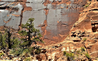
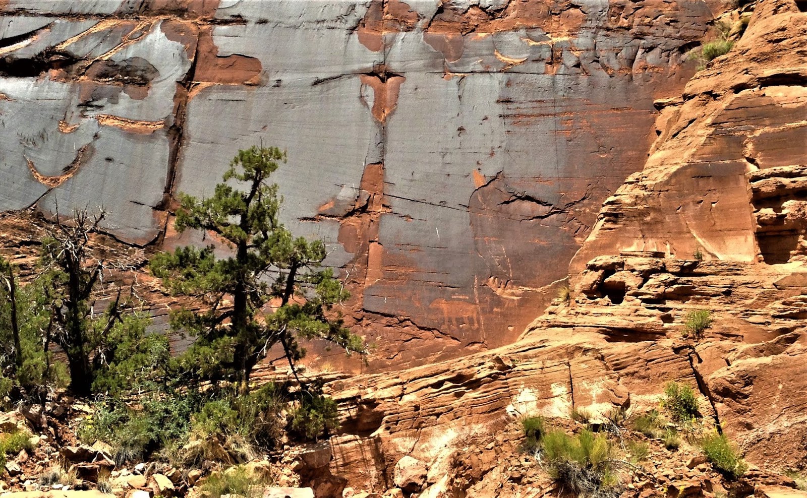
As was typical of Fremont petroglyph sites, the artists chose large smooth areas of oxidized rock for their canvas in places that were at least somewhat sheltered from the elements. These galleries are often concentrated in a single area so some people think they may have been places designated for ceremonies.
 |
| Petroglyph cliffs with orchards in foreground |
Many of the petroglyphs depict hunting scenes or mythical beings. They may have been recordings of past events or the illustrations of legendary tales.


there is a bit of modern graffiti here but fortunately the settlers and there descendants did not damage the original pictures.

There is evidence that the Fremont People used irrigation and this valley flooded often during pioneer days so the early farmers had silted, watered fields to work with. The Mormon pioneers did them one better and dug a canal across a bend in the river to irrigate their orchards.
 |
| An old apricot orchard |
They raised stone fruit and apples. A woman I met that had farmed here said peaches were her most profitable crop.
Fruita was a small community, judging by their school.
 |
| Fruita schoolhouse |
Today the homes of Fruita are gone but the orchards and a few relics remain. The same can be said of the ancient residents who left their mark on the cliff faces.
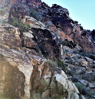
Almost 100 miles west of Capitol Reef, Fremont Indian State Park is the site of one of the largest Fremont settlements ever discovered. The park was established at the spot where Interstate 70 passes through Clear Creek Canyon near Sevier, Utah. Unfortunately, the hill that was the site of the Fremont village was mostly destroyed to make way for the freeway. Fortunately, archaeologists from the state and Brigham Young University were able to map the sight and save many artifacts before the hill was radically sliced up.

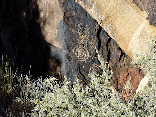
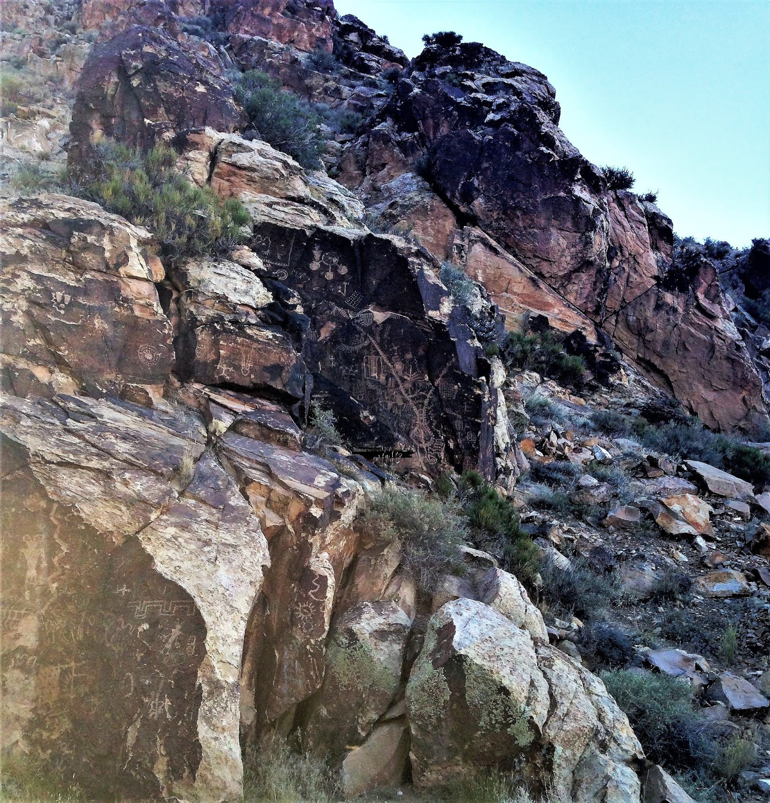
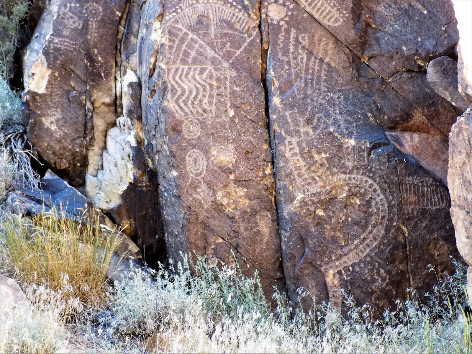
The park's visitor center sits across the freeway from the village next to a group of petroglyphs thought to be a ceremonial site.

This small side canyon has many typical scenes.


The indications are that the Fremont farmed the valley floor and hunted in the side canyons. They lived in pit houses which would have been comfortable in most seasons and surprisingly well ventilated. The rock formations around the petroglyphs give the area a cathedral like atmosphere.

There is no dam on Clear Creek so except for the freeway the area has changed little since it was inhabited by ancient people.

A journey of another 100 miles southwest brings you to Parowan Gap, ten miles west of Parowan, Utah. This is not the site of an ancient village but a collection of petroglyphs along an ancient trail leading out into the desert. It also acts as a solar calendar, marking the summer solstice when the setting sun strikes one of the designs.

The value in this may have been that it told the ancient people when they could expect to find foods they would forage for in the desert at the stage to be harvested.
The Gap is well named.
 |
| Late afternoon from the west |
 |
| Early evening from the east |
This is The Great Basin so mountains are piles of rock with little vegetation.

The variety of subjects here is huge including some rather abstract looking representations. Both the Hopi and Southern Paiutes have given interpretations of some of these pictures. It's a good bet both have history here.


The number of pictures is probably over one hundred.


I was there on June 20 and was able to record the sunset.

As advertised, the sun split the gap and hit a stone cairn while I and several partiers applauded.
These sites are not well known which gives the visitor the opportunity to experience them without crowds and traffic. After all, they were important to the communal and religious life of the people who created them and are best appreciated in an atmosphere of respect.

Spring of 2019 found me in Moab, Utah where I was able to visit two petroglyph sites that were previously unknown to me. The first is on Kane Creek Road which follows the left bank of the Colorado River for a few miles then turns into a narrow gravel track that winds through the hills. The site here is called "Birthing Rock" and it is unusual in that it is not on a canyon wall but on a single boulder sitting alone on the side of a hill.

Several styles are represented here which indicates that the pictures were created over many years time.

The "Birthing" figure is in the upper left on this panel. Our group had extensive discussions of what the various gylphs represent but even with a guide book it's hard to determine.

 |
| A separate panel on the "Birthing Rock" |
 |
| A later panel, probably Ute, depicting horses and bear paws. |
 |
| Another view of the "Birthing Panel" |
Across the river on the right bank is an area locally known as "Wall Street" because it is heavily used by rock climbers. This is accessed from Highway 279 aka "Potash Road".


Downstream from the climbing area is a protected area of rock art.

there is a mixture of styles here as well which indicates use over a long time period.


Most of these figures were likely created by the Fremont Civilization but there is also an unusual one called the "Bear Panel" that may have been archaic Ute.

Another factor that dates these pictures is their height on the cliff face. Obviously the river valley has eroded a lot since they were created.

The petroglyphs in the picture above are on the black oxidized section of the cliff.


The height of these works make them hard to see and photograph but it also protects them. I hope by clicking on these photos and enlarging them you will get a good feel for what they look like in person. these are only two of many such sites in the Moab area and I plan to document more in the future.


Comments
Post a Comment