Day 4 The Midwest
The first indication that you are in the Midwest is the humidity. When I awoke in the Victorian styled inn in Council Grove, Nebraska it was already in the mid-seventies and humid. As a resident of Utah, my normal condition is wrinkled, cracked, and flaky, but I was destined to spend this day damp and greasy.


The council grove on the Neosho River had been a meeting place for the regional nations long before Americans began to encroach on the area, the Kanza, Kaw, and Osage are traditional occupants of this valley, but in the context of the Santa Fe Trail it is important as the place where the U.S. government paid the Osage for the right of transit for this section of the trail.

What I never saw mentioned on the signs was the fact that this was the staging area for Kearney's Army of the West that traveled to Santa Fe via Bent's Fort in 1846 to invade Mexico and claim New Mexico and California for the United States. At the historic sights toward the west end of the trail, such as Bent's Fort, it was repeatedly emphasized that in these far west settlements Americans, Mexicans, and Natives lived and worked together in a cooperative fashion. That was to end after 1846.
Council Grove contains many preserved historic sights and buildings and aims at drawing tourists by holding festivals and reenactments. It seems like a good place to stay but I don't see it as a destination.


Throughout western Kansas you are often reminded of the prominent role played by the Missouri, Kansas, and Texas Railroad, The Katy. When "She caught the Katy and left me a mule to ride", she was traveling in style.


Council Grove is very near the eastern end of the Santa Fe Trail and although the starting point later moved to Independence, the first origin was Franklin, Missouri. Since Franklin was on the Missouri flood plane it was soon moved up the hill to its permanent location of New Franklin. To get there, the trail passes through the scenic Flint Hills. This is rolling country mostly dedicated to grazing cattle.

Moving east, the trees increase and the land levels out a bit. It's mostly farms and suburbia as you circumvent Kansas City and move into the Missouri hill country. New Franklin itself is a small town in the middle of country settled by Daniel Boones's family and many of the place names reflect this.

New Franklin is so close to the Missouri River that it is also a part of the Lewis and Clark Trail. You could call it a jumping off point for "Manifest Destiny" or a staging point for the invasion of the west depending on your point of view.
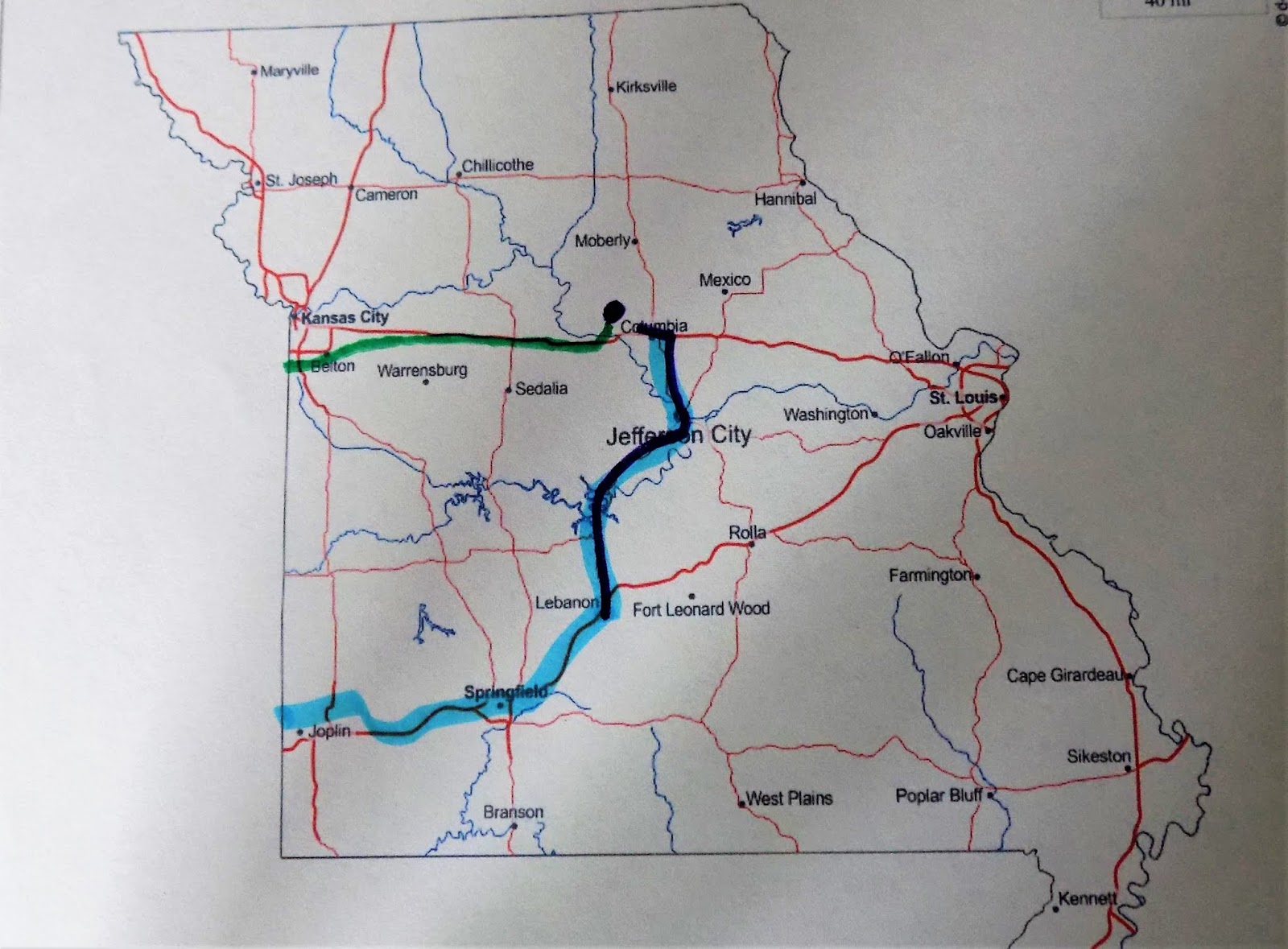
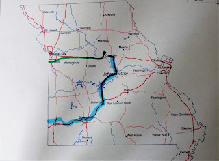
The green on the map above is the last leg of the Santa Fe Trail. I picked up route 66 in Lebanon, MO where the highlighting turns to light blue. Map courtesy of d-maps.com.
Having reached the source of the Santa Fe Trail, it was time to head south to join Route 66. To get there I traversed the Missouri hills area and the Ozarks. The flood plain farms along the river were plowed and ready for planting.

The hill farms were nice to look at and often contained large Cargill turkey raising facilities. This is definitely poultry country and I passed a semi loaded with Tyson chickens on their way to slaughter.

After spending so much time in scenic farm country it was disappointing to drive through the Ozark Lake region which is dominated by condos and marinas. It is obviously a playground for city dwellers and holds no attraction for me. I can't wait to reach Route 66 and get back to small town America.


Comments
Post a Comment